LSSE provides a broad spectrum of Geographic Information Systems (GIS) services and supports municipal facilities planning, capital improvement, asset management, and operations and maintenance programs on projects located throughout the Tri-state region.
Services are delivered through the ArcGIS Platform which includes: ArcGIS Desktop, ArcGIS Online, and mobile field data collection for analysis and integration into GIS and other systems.
LSSE’s recent project experience includes:
- Sewage infrastructure mapping/development of GIS infrastructure inventory database for various municipalities in Allegheny County, Pennsylvania
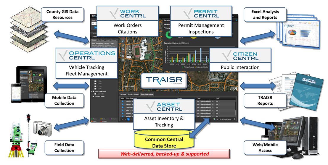
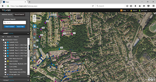
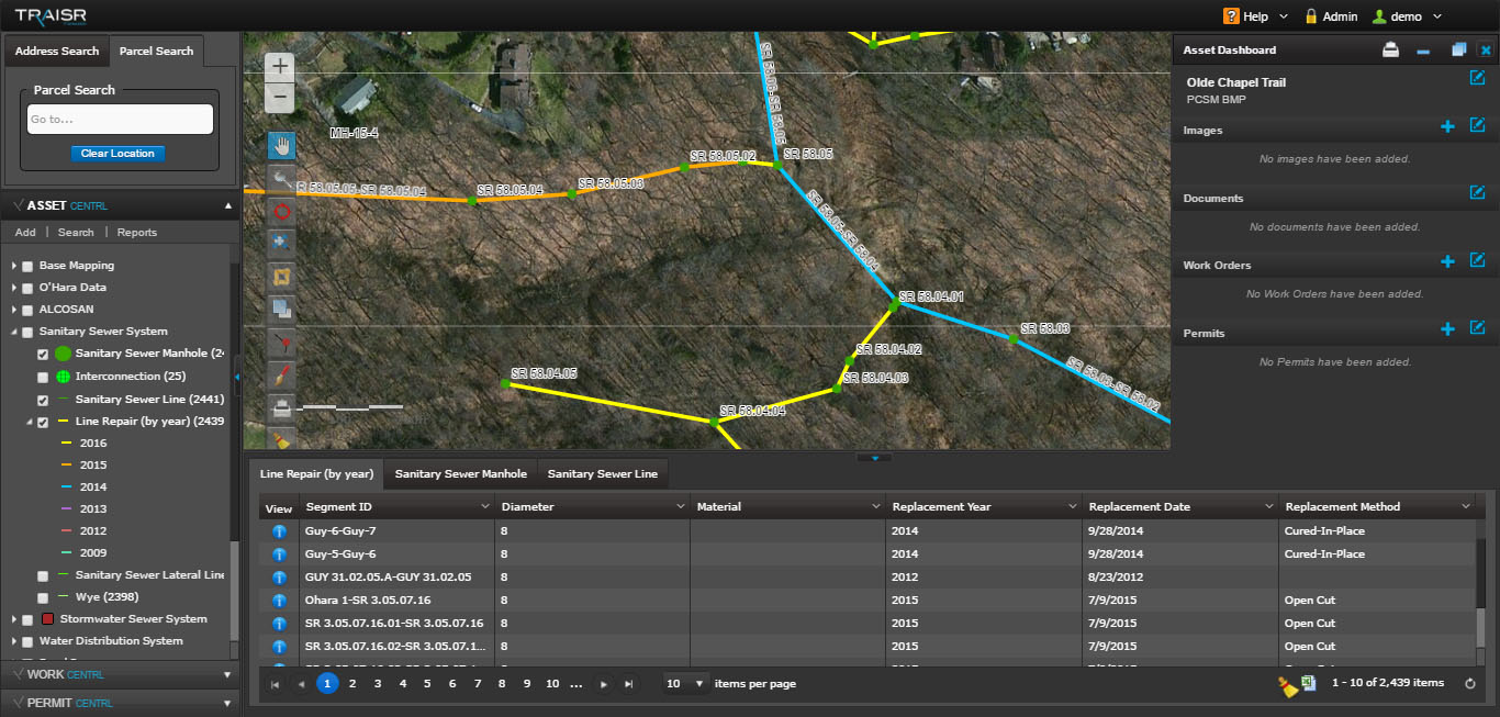
- TRAISR™ is a web-based GIS utilized to assist municipal managers and local agencies with asset management, planning, and managing daily operations and managing work flows
- Stormwater management through MS4 compliance, development of Pollutant Reduction Plans (PRP), and assisting in plans for municipalities to fund the costs of meeting current/future regulations by performing analysis which supports development of stormwater fees
GIS Services include:
- GIS Planning
- Customized System Implementation and Integration
- Asset Management
- GPS/GIS Integration
- Local Government Data Models
- Data Development, Migration, and Maintenance
- Desktop, Web, and Mobile Mapping
- Web Maps, ArcGIS Online Apps
- TRAISR
- Training and Support
GIS Applications include:
- Infrastructure and Utilities Mapping, Inventory, Assessment and Asset Management
- Property Inventory, Assessment, Permitting and Code Enforcement
- Operations and Maintenance Plans
- Building Permits/Code Enforcement
- Land use/Zoning Studies and Management
- Sanitary Sewer Evaluation Studies (SSES), Corrective Action Plans (CAP), I/I Source Flow Reduction and Flow Monitoring
- Hydraulic Characterization Studies/Modeling
- Operations and Maintenance/CMOM Regulations
- NPDES Phase II Stormwater Regulations
- MS4 Compliance